-40%
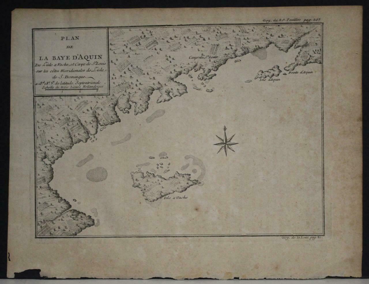
ÎLE-À-VACHE HAITI 1725 ANONYMOUS UNUSUAL ANTIQUE ORIGINAL COPPER ENGRAVED MAP
$ 5.27
- Description
- Size Guide
Description
ÎLE-À-VACHE HAITI 1725 ANONYMOUS UNUSUAL ANTIQUE ORIGINAL COPPER ENGRAVED MAPÎLE-À-VACHE HAITI 1725 ANONYMOUS UNUSUAL ANTIQUE ORIGINAL COPPER ENGRAVED MAP
Description
Plan de la Baye d'Aquin De L'isle a Vache, et du Caè St. Louis sur les côtes Meridionales de L'isle de S. Domingue.
Description:
Striking and highly detailed fine unusual
1725 copper engraved map depicting the souther coastline of thw Île-à-Vache, Haiti, West Indies. The map is filled with some topograhic features. A block-style cartouche includes the title and a mileage scale. A conpass rose completes the map.
Île-à-Vache, (French, also expressed Île-à-Vaches, former Spanish name Isla Vaca; all translate to Cow Island) is a Caribbean island, one of Haiti's satellite islands. It lies in the Baie de Cayes about 6.5 miles (10.5 km) off the coast of the country's southwest peninsula, roughly between the town of Les Cayes and Pointe l'Abacou. It was formerly known by the name of Abacca. Administratively, it became a commune in 1976 as part of the Les Cayes Arrondissement in the Sud department.
Île-à-Vache was claimed by the Spanish Empire in 1492 as part of Hispaniola, and for the next two centuries it was known by the name Isla Vaca. In 1697 the island of Hispaniola was formally divided between Spain and France in the Treaty of Ryswick which ended the Nine Years War. France assumed control of the western half of Hispaniola and named it Saint-Domingue, and Isla Vaca took on its current name, Île-à-Vache.
Date:
1725 ( undated )
Dimension:
Paper size approx.:
cm 25,2 x 19,4
Condition:
Very strong and dark impression on good paper. Paper with chainss. Map uncolored. Wide margins. Corners partially missing. Small foxing and browning. Conditions are as you can see in the images
.
All of the maps we sell are ORIGINALS. We guarantee all of our maps to be authentic. We do our best to describe the condition of our maps as accurately as possible. Due to the age and type of paper, some imperfections are to be expected. Please examine the images provided carefully, and if you have any questions please ask and we will be happy to help.
A Certification of Authenticity ( COA ) can be issued on request
I will send you all your item by Registered and Insured Airmal or by TNT/DHL with covering Insurance
If you buy more than one item you have to pay just one only shipping cost
Any map purchased from us may be returend for any reason for a full refund.
Shipping: Customs may be charged on international shipments. All customs charges are the responsiblity of the buyer and are not included in the selling price.
About:
Old Times
Rare Antiquarian Books & Maps Sellers
Our Firm was founded in 1983 and we are specialized on antiquarian works on paper concerning Antique Rare Maps, Atlases and Travel Books of all the World.
Our Firm adheres to the Codes of Ethics outlined by the Italian Antiquarian Booksellers Association ( ALAI ) and International League of Antiquarian Booksellers ( ILAB ).
All items sold by OLD TIMES are genuine and a Certificate of Authenticity (COA) will be happily supplied on request.
Many Thanks
Cesare Giannelli
OLD TIMES
RARE ANTIQUARIAN BOOKS & MAPS SELLERS
Via Cortonese, 70
06124 - Perugia
Italy
Phone/Fax: 0039 - 075 - 505 20 18
http://www.oldtimesrarebooks.com
View My Feedback
View My Other Items For Sale
View My About Me page
Visit My eBay Store
Add me to your Favorite Sellers
Click images to enlarge
Get images that
make Supersized seem small.
Showcase your items with Auctiva's
Listing Templates!
THE simple solution for eBay sellers.
Track Page Views With
Auctiva's FREE Counter


