-40%
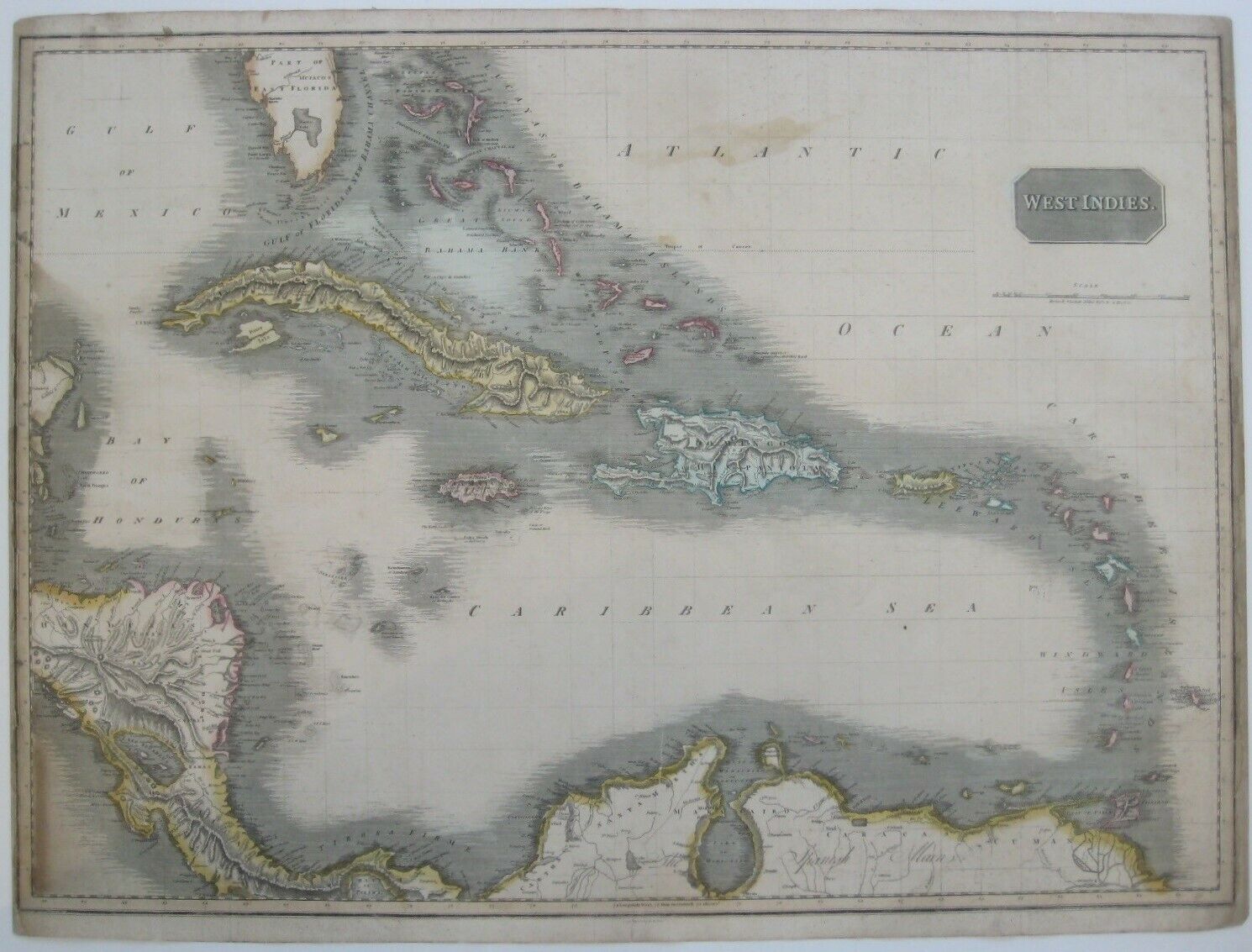
Original 1815 Thomas Clerk Map WEST INDIES Cuba Jamaica Florida Spanish Main
$ 105.59
- Description
- Size Guide
Description
Beautiful, large-format circa 1815 antique map of the West Indies in original hand color, engraved by Thomas Clerk more than 200 years ago.The overall image area measures a generous 49.5 x 68.6 cm [19½" x 27"] on a double-folio sheet. The distance scale is calibrated in British statute miles, and longitude is measured from Greenwich.
There's attractive shading along the coast lines, and topography is drawn in relief.
The coverage area extends from the Bay of Espiritu Santo or the Tampa Bay area on the coast of East Florida to the northern coast of South America, including Panama, the Bay of Honduras, the Bahamas, and the islands of the Caribbean.
Territory on either side of Lake Maracaibo is labeled "The Spanish Main;" other named places and features include Cuba, Havana, Jamaica, Virgin Isles, Aruba, Trinidad, Grenada, Dominica, Guadeloupe, Lake Nicaragua, Exuma Sound, Tropic of Cancer, Hispaniola, and Puerto Rico (spelled Porto Rico).
In Florida there is a large inland lake, labeled Mayaco, which is no doubt an embryonic representation of Lake Okeechobee.
There is extraordinary detail throughout, noting both physical and political elements, including shoals, reefs, and other undersea dangers. Certainly one of the most attractive maps of the West Indies to appear in the early 19th century.
Condition:
The margins at left and right have darkened and are trimmed close to the neat line. The vertical folds have been reinforced on the verso, and the map is printed on a heavy paper, with some minor soiling. It is blank on the back, with no printing on the reverse side. Please see the scans and feel free to ask any questions.
This is an
original
, authentic antique map,
not
a reproduction or modern reprint, and it is fully guaranteed to be genuine.
It is undated and the imprint in the lower margin reads: "Eng'd by T. Clerk, Edin'r." Thomas Clerk was an engraver in Edinburgh and is best known through maps he engraved for John Thomson's
New General Atlas
in 1814. His maps also appeared in
A Modern Atlas
by the English cartographer John Pinkerton, published in London by Cadell & Davies and by Longman, Hurst, Rees, Orme & Brown, and in Philadelphia by Bradford & Inskeep and by Thomas Dobson & Company. Clerk is also known for engraving maps and plans of Scottish towns between 1810 and 1830.
Buy with confidence! We are always happy to combine shipping on the purchase of multiple items — just make sure to pay for everything at one time, not individually.
Powered by SixBit's eCommerce Solution


