-40%
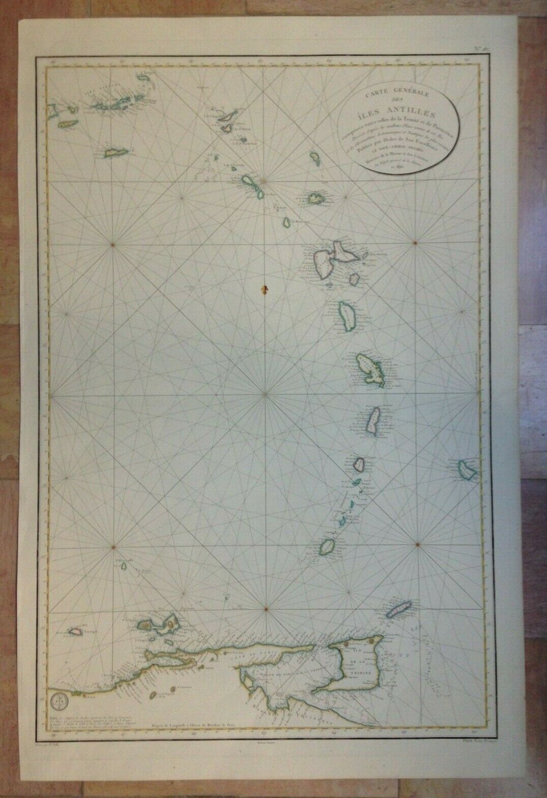
CARIBBEAN 1806 DEPOT DE LA MARINE VERY LARGE ANTIQUE SEA CHART IN COLORS
$ 316.8
- Description
- Size Guide
Description
Title of the map:"CARTE GENERALE DES ILES ANTILLES comprises entre celles de la Trinité et de Porto-rico, Dressée d'après les meilleurs Plans connus de ces iles et les Observations Astronomiques et Nautiques les plus récentes, Publiée par ordre de son Excellence LE VICE-AMIRAL DECRES Ministre de la Marine et des Colonies Au Dépot Général de la Marine en 1806
"
Very large antique sea chart of Caribbean, copper engraved by E. Collin, from Depot General de la Marine.
The map depicts eastern Puerto Rico and Culebra and Viegues islands, the British Virgin islands, Anguilla, St Kitts, Nevis, Montserrat, Antigua, Barbuda, Guadeloupe, Dominica, Martinique, Ste Lucia, St Vincent, Grenada, Barbados, Trinidad and Tobago, and the northern part of Venezuela.
Size with margins :
97,5 x 65 cm / 38,1 x 25,5 inches
Condition :
very
good condition
, handed colored, large margins
.
Edition :
Paris, dated 1806
, the Depot de la Marine stamp in right bottom of the map, XIXe Century.
The Depot de la Marine, also named as Depot des cartes et plans de la Marine, was the official institution of maps in F
rance. It has been created by Philippe d'Orléans, named Le Regent (1674-1723).
This institution was the contributor of the knowledge in France about marine and navigation. Most of mapmakers worked for it, as Nicholas Bellin, Buache, Bauche, Bonne and Beautemps-Beaupré. The D
epot became in 1806 the Naval Hydrographic service, and still exists today with the name SHOM ( service hydrographique et océanographique de la marine).
If you buy more than one item, you have to pay just one only shippi
ng cost.
All shipments are insured.
We send maps by DHL.
WE DON'T SELL LASER AND COPIES MAPS, ALL WE SELL IS ORIGINAL AND ANTIQUE
Due to the age an type of paper, some imperfections are to be expected. Please examine the images provided carefully, and if you have any questions please ask and we will be happy to help you


