-40%
Antique Map of Central America by Wyld (1850)
$ 588.77
- Description
- Size Guide
Description
See our ratingsAdd this shop to my favorites
Antique Map of Central America by Wyld (1850)
$ 1,115.11
Availability:
in stock
Condition
: Good, general age-related toning. minor wear and soiling. Original folding line and foldout. Blank verso. Please study image carefully.
Date
: 1850
Overall size
: 85.5 x 58.4 cm.
Image size
: 81 x 58 cm.
Description:
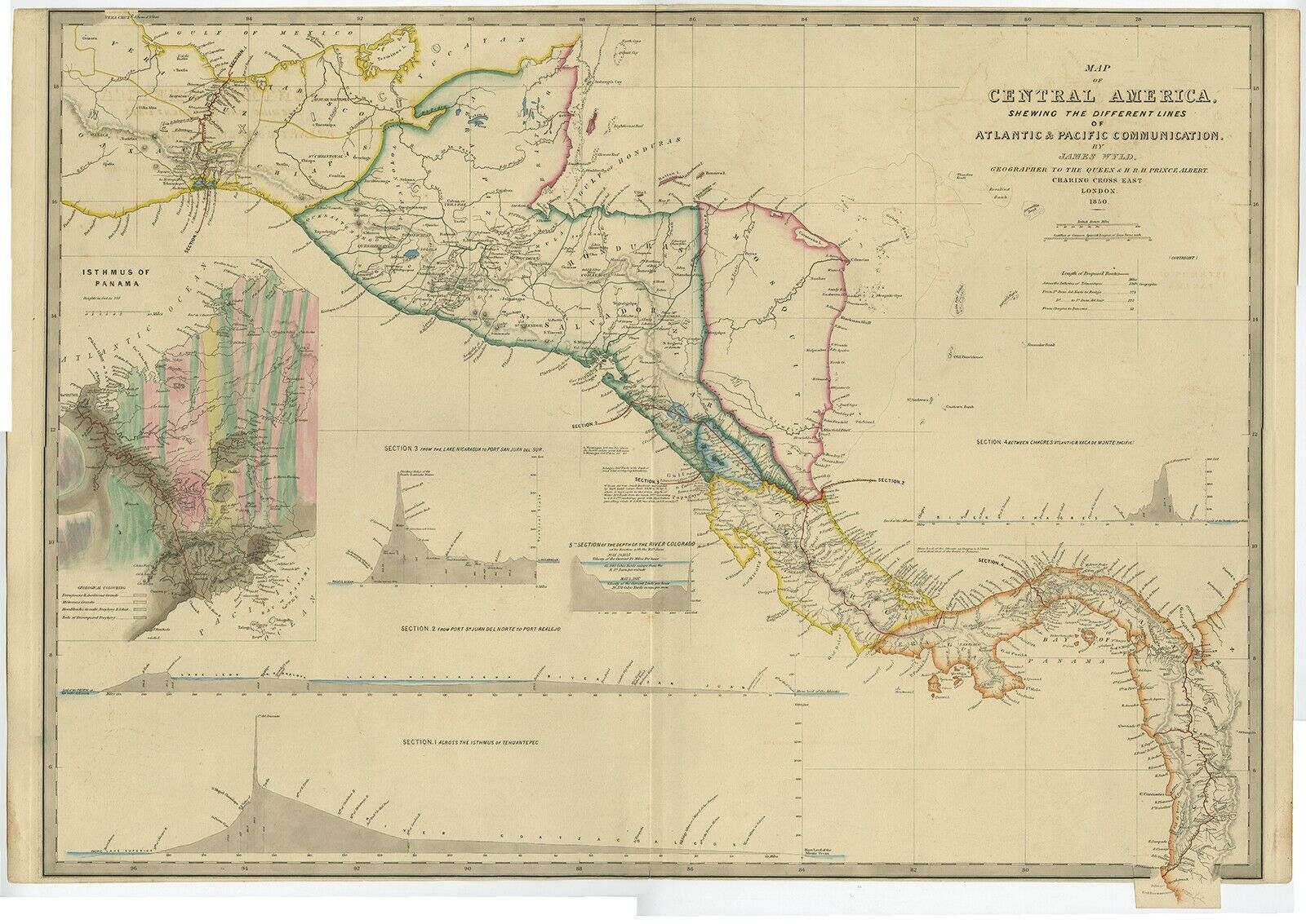
Antique map titled 'Map of Central America Shewing the Different Lines of Atlantic & Pacific Communication'. A most unusual U.S. Government edition of this handsome map of Central America executed by Englishman James Wyld and published in a report to Congress. At the time, there was great interest in Central America as the site for a land transit that would cut weeks off a journey to California and the gold fields. The map shows four sections: Across the Isthmus of Tehuantepec; from Port Sn. Juan del Norte to Port Realejo; between Charges (Atlantic) &c Vaca de Monte (Pacific); and from the Lake Nicaragua to Port San Juna del Sur. A large and very colorful inset shows the Isthmus of Panama and the planned route in great detail. Printed on much heavier paper than the typical government document. Source unknown, to be determined.
Artists and Engravers:
James Wyld (1812–1887) was a British geographer and map-seller, best known for Wyld's Great Globe. He was successor to William Faden, one of the luminaries of late eighteenth century publishing in England. Wyld maintained the high standard of graphic and factual excellence that had been established by his predecessor and his maps are among the finest published in the early nineteenth century.


