-40%
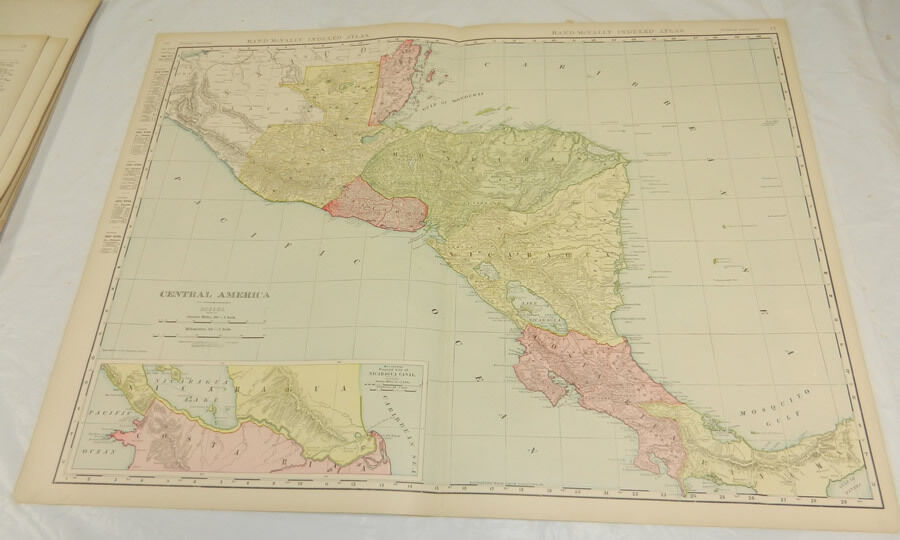
1908 Rand McNally MAP of CENTRAL AMERICA & PANAMA/Huge 20.5x28"/Includes Index
$ 18.45
- Description
- Size Guide
Description
THIS ITEM IS A GENUINE ORIGINAL VINTAGE MAPFROM THE SOURCE/DATE LISTED
Name - Central America, backed with Panama and Indexes
Date - 1908
Source - Rand, McNally and Company Indexed Atlas of the World, Historical, Descriptive, Statistical
Comment - This item is from an early and fairly rare and scarce Atlas issued in a large-format, and is fully indexed. Rand McNally was among the earliest map-makers to include this full index, which this year included information such as Towns, Districts, Lakes, Rivers, Mountains, Islands, Creeks, etc.
Size - About 20.5x28", double page
Index - Printed on the reverse of the Central America map, and below the Panama Map which includes the Panama Canal. Central America includes Costa Rica, Nicaragua, Salvador, Honduras, and Guatemala
Condition - Fine
Yes!! We Do Combine Shipping on Multiple Purchases!!
NO RESERVE!! Happy Bidding!
Shipping and etc.:
Buyer pays shipping/packing.
We use very secure packaging methods and materials, and all shipments within the United States
will be made with the protection of the new USPS Parcel shipping category.
(First Class or Priority, depending on weight)
Note that certain items may be shipped in the USPS Media Mail category, if appropriate.
Payment due within 14 days after our initial after auction contact.
Pennsylvania residents MUST add applicable SALES TAX
or send resale number.
Thanks.
Good Luck!
To See Our Other Auctions and Store Items CLICK HERE!
Powered by
eBay Blackthorne 04.10.043


