-40%
1894 Perron map BELEM, PARA, BRAZIL (#40)
$ 10.53
- Description
- Size Guide
Description
Perron19_0401894 Perron map BELEM, PARA, BRAZIL (#40)
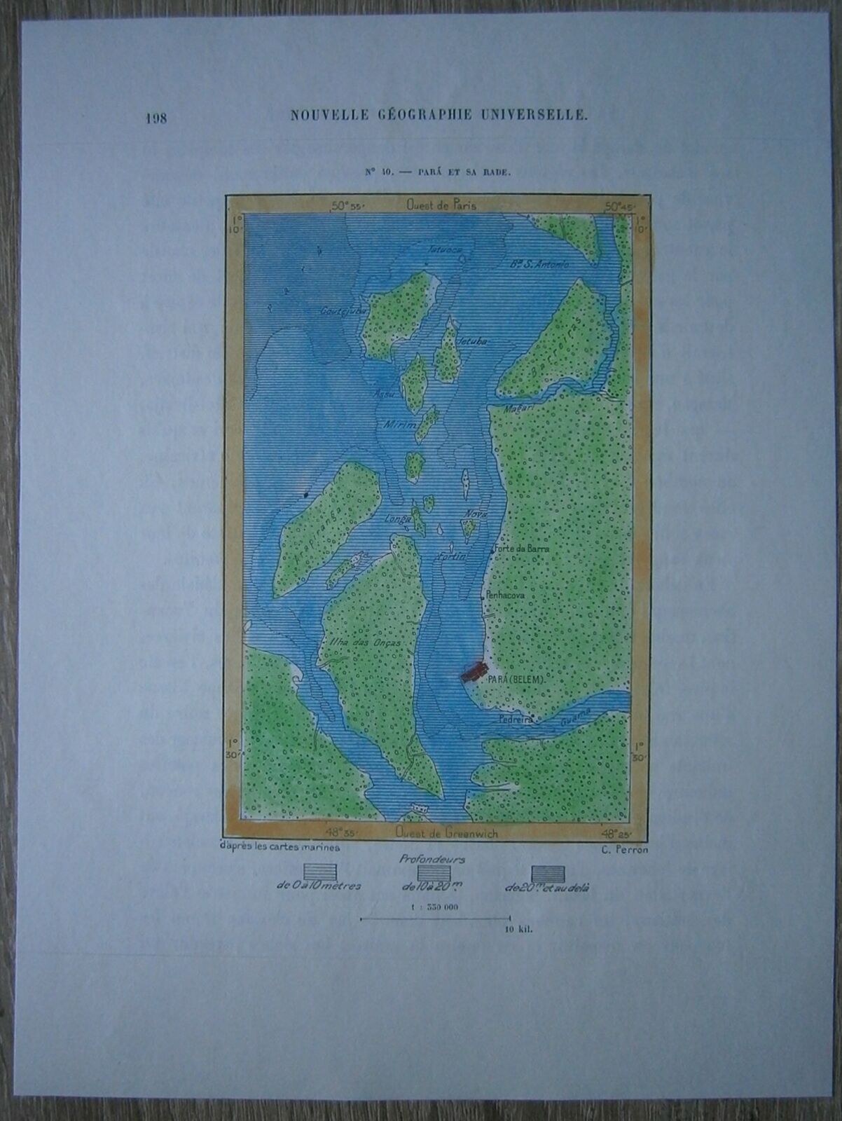
Nice map titled
Para et sa rade,
from wood engraving with fine detail and clear impression, nice hand coloring. Overall size approx. 22.5 x 16.5 cm, image size approx. 12.5 x 8 cm. From
La Nouvelle Géographie universelle, la terre et les hommes
, 19 vol. (1875-94), great work of Elisee Reclus. Cartographer is Charles Perron.
Belem
,
also called Pará, city and port, capital of Pará state, northern Brazil, on the Baía do Guajará (Guajara Bay), part of the vast Amazon Delta, near the mouth of the Rio Guamá, about 80 miles (130 km) up the Rio Pará from the Atlantic. Its climate is equatorial, with an average annual temperature of 80° F (27° C) and an annual rainfall of 86 inches (2,175 mm).
In 1616 the fortified settlement of Feliz Lusitânia, later called Nossa Senhora de Belém do Grao Pará (Our Lady of Bethlehem of the Great Para River) and Santa Maria de Belém (St. Mary of Bethlehem), was established, consolidating Portuguese supremacy over the French in what is now northern Brazil. Belém was given city status in 1655 and was made the state capital when Pará state was separated from Maranhao in 1772. The early decades of the 19th century were marked by political instability. Uprisings and internecine strife were finally ended in 1836, after considerable loss of life.
The sugar trade was important in the Belém region until the end of the 17th century. Thereafter the city's economic importance alternately rose and fell. Cattle ranching supplanted sugar until the 18th century, when cultivation of rice, cotton, and coffee became profitable. With the settlement of southern Brazil, where such crops could be produced more reasonably, Belém declined again. The city subsequently became the main exporting centre of the Amazon rubber industry, and by 1866 its position was further enhanced by the opening of the Amazon, Tocantins, and Tapajós rivers to navigation. The rubber era terminated after the boom of 1910–12, but Belém continued to be the main commercial centre of northern Brazil and the entrepôt for the Amazon Valley.
The most valuable products now exported from the Amazon by way of Belém are nuts (chiefly Brazil nuts), black pepper, cassava, jute, wood veneers, and aluminum. Japanese immigration after the 1930s was an important factor in developing jute and black pepper, notably at Tomé-Açu, just south of Belém, and near Santarém. Marajó Island, the largest fluvial island in the world, which lies just across the Rio Pará from Belém, has some livestock grazing. Electricity is provided by the massive Tucuruí Dam, some 200 miles (300 km) southwest of the city on the Tocantins River.
Belém has a modern appearance with tree-lined streets, several plazas and public gardens, and many noteworthy buildings. The north's leading educational and cultural centre, it is the seat of a bishopric, and its cathedral, founded in 1917, is one of Brazil's largest. Santo Alexandre, the oldest of Belém's churches, was built in 1616. The Museu (museum) Paraense Emílio Goeldi, the Teatro da Paz (a classical theatre), and the public library and archives are other notable institutions. The Universidade Federal do Pará (1957) is in the city, which also has a teachers' training school, an agricultural institute, and an institute for research on tropical diseases.
Belém is the main port for Amazon River craft and is served by international and coastal shipping and by inland vessels south to Brasília. Paved roads extend to Piavi and Goiás states. A railway leads 145 miles east-northeast to Bragança, and Belém's international airport is northern Brazil's largest. Pop. (1980) 755,984; (1991 prelim.) 765,476, metropolitan area, 1,332,723.


