-40%
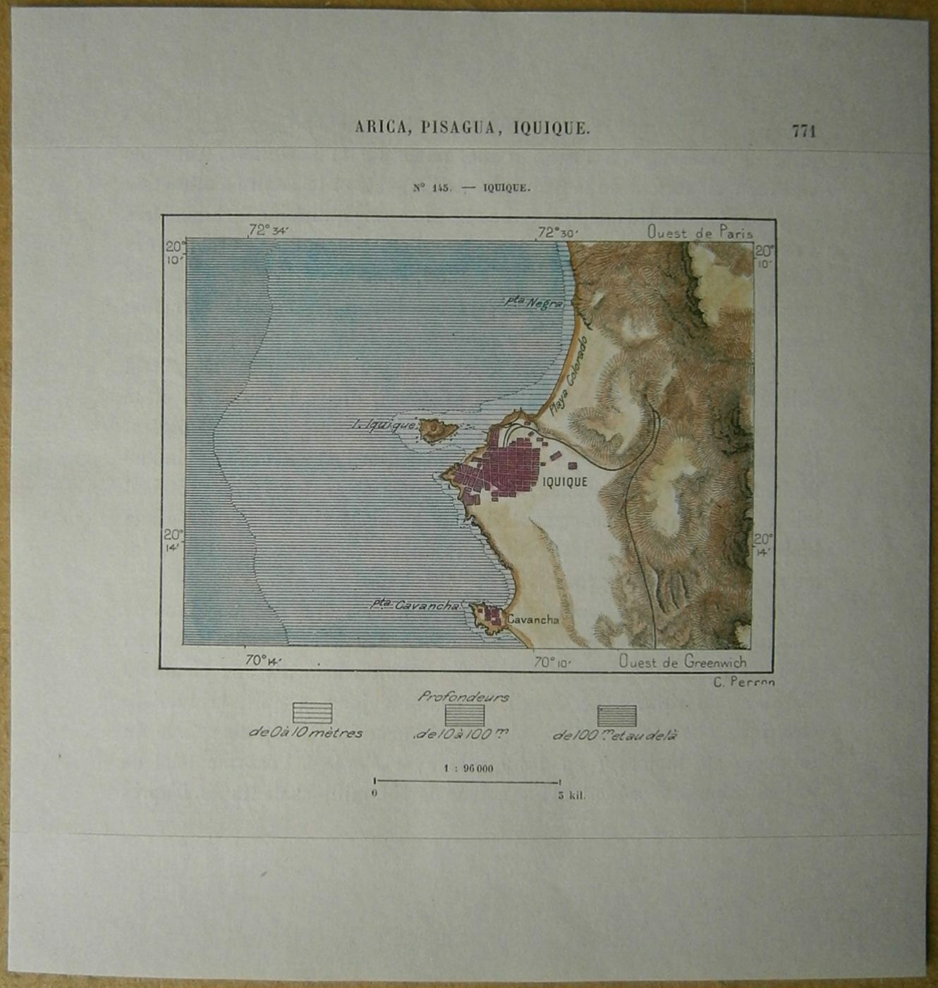
1893 Perron map IQUIQUE, CHILE (#145)
$ 10.55
- Description
- Size Guide
Description
Perron18_1451893 Perron map IQUIQUE, CHILE (#145)
Nice map titled
Iquique,
from wood engraving with fine detail and clear impression, nice hand coloring. Overall size approx. 17 x 16 cm, image size approx. 10 x 7 cm. From
La Nouvelle Géographie universelle, la terre et les hommes
, 19 vol. (1875-94), great work of Elisee Reclus. Cartographer is Charles Perron.
Iquique
capital of Iquique provincia and of Tarapacá región, northern Chile. It is located on a rocky peninsula in the rainless Atacama Desert, overlooking the Pacific Ocean. Its anchorage is protected from the open sea by the low, barren offshore island of Serrano, which is connected to the mainland by a stone causeway. Founded in the 16th century, the city was partially destroyed in 1868 and 1875 by earthquakes, but some old wooden houses from that time still stand. During the desert's nitrate boom of the 19th and early 20th centuries, Iquique was Chile's major export port. Following the decline in nitrate prices, the city stagnated.
In an effort to revive the economy, new port facilities have been installed and new industries established. Fish-meal plants and canneries are in operation. Guano on the coast and offshore islands is exploited, and salt deposits to the south are worked. New lands have been opened up by irrigation for the cultivation of fruits (especially citrus), sugarcane, and olives. Tourism, based on sport fishing and beach facilities, also contributes to the economy. Iquique is linked to other cities by the main north–south Pan-American Highway and by railroad; it also has an airport. Pop. (1990 est.) mun., 149,482.


