-40%
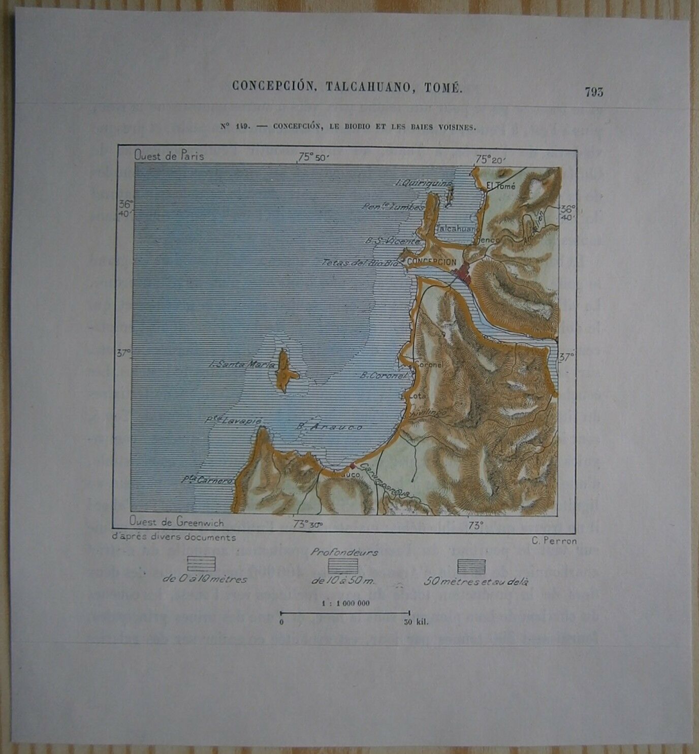
1893 Perron map CONCEPCION & BIO-BIO RIVER, CHILE (#149)
$ 11.61
- Description
- Size Guide
Description
Perron18_1491893 Perron map CONCEPCION & BIO-BIO RIVER, CHILE (#149)
Nice map titled
Concepcion, le Biobio et les baies voisines,
from wood engraving with fine detail and clear impression, nice hand coloring. Overall size approx. 17.5 x 16 cm, image size approx. 10 x 8.5 cm. From
La Nouvelle Géographie universelle, la terre et les hommes
, 19 vol. (1875-94), great work of Elisee Reclus. Cartographer is Charles Perron.
Concepción,
in full CONCEPCIÓN DE LA MADRE SANTÍSIMA DE LA LUZ, capital of Concepción provincia and of Bío-Bío región, south-central Chile. Concepción lies near the mouth of the Bío-Bío River. Chile's second largest city, it was founded in 1550 on the site of what is now Penco and was shortly afterward burned twice by Araucanian Indians. It was struck by numerous earthquakes, two of them followed by tidal waves (1730, 1751), and in 1754 it was moved inland to its present site, 6 miles (10 km) from the river's mouth and 43 feet (13 m) above sea level.
Despite frequent earthquakes, Concepción has become a major commercial and industrial centre, its other geographic assets aiding its development. Concepción Bay, to the north, is large and protected; and the Bío-Bío River provides a corridor through the coastal mountains to a valley region where agricultural and forest industries are well developed. The river's volume and hydroelectric potential are ample for the region's foreseeable requirements. Most of Chile's coal is mined near the city. The railway serving the major mines ends in Concepción, as do the railways that follow the Bío-Bío and Itata rivers into the interior. The Itata railway links the industrial and resort towns on the eastern shore of Concepción Bay, while a local railway serving the southwestern side of the bay joins the outport of Talcahuano (q.v.), Huachipato, and San Vicente with Concepción. San Vicente is both a resort and a source of fresh and preserved seafood for Santiago, the nation's capital, 260 miles (420 km) northeast. The Huachipato steel mill (operational since 1950), a petroleum refinery (1966), and the San Vicente chemical complex (established in the early 1970s) were major additions to Concepción's industries, which include textiles, food processing, woodworking, glassmaking, and brewing. South of the river is a paper factory, and upstream is a cotton mill. Concepción is an episcopal see and the seat of an appellate court and has a university founded in 1919. Pop. (1993 est.) mun., 318,140.


