-40%
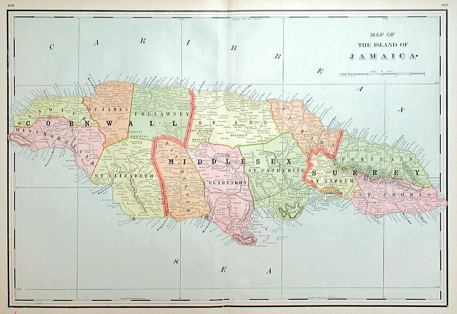
1890 JAMAICA MAP by H. WALKER, LARGE ANTIQUE DETAILED MAP
$ 26.37
- Description
- Size Guide
Description
Original Antique Map from "Walkers International Atlas”, c. 1890JAMAICA
M-4622:
“MAP OF THE ISLAND OF JAMAICA”
Philadelphia: Henry B. Walker, c. 1890. From the scarce large folio edition of “
Walker’s International Atlas
.” Large color-printed map with original color and centerfold as issued. (Paper size: 17.5 x 25 inches – Image size: 16 x 23.25 inches)
This unusually detailed map depicts
Jamaica
with the three provinces (Cornwall, Middlesex and Surrey) shown and the fourteen parishes delineated and in contrasting pastel colors.
Topographical features are well noted with major towns, cities, islands, mountains, and waterways identified. A very informative view of the island as it existed late in the 1800’s.
Original map about 130 years old, not a reproduction - in nice condition as shown in the photos.
It comes with a certificate of authenticity.
We have been full-time dealers in Illuminated Manuscripts, Maps, Prints and Antiquities since 1980.


