-40%
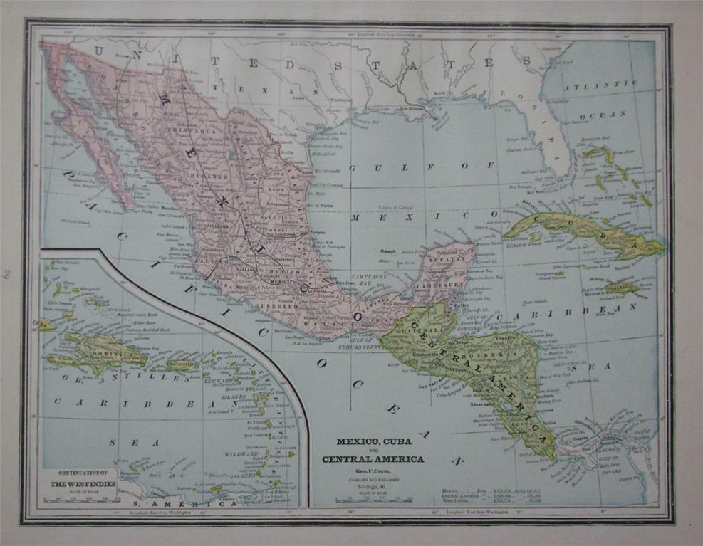
1887 Mexico, Cuba & Central America Original Color Atlas Map** w/ Populations
$ 5.25
- Description
- Size Guide
Description
1887 Mexico, Cuba & Central America Original Color Atlas Map** w/ PopulationsGorgeous, Original 1887 Mexico, Cuba & Central America color map.
This is an
ORIGINAL...NOT A REPRINT
... 132
year-old undated atlas map...The total size of the entire map measures 13 1/2 " x 10 1/2 " with the borders...
The map includes area and population for Mexico, West Indies and Central America; it shows towns and cities, major railroads, rivers, and other Geographic features, etc. Great, Historic Item ...
NOTE CONDITION:
The map has a little border and corner wear, overall, it is in Nice Condition and will look wonderful matted and framed.
(These old maps make great gifts)!!!!...
Please see the attached photo
to view the Map
, and a couple of closeup sections of the map.
Please note that the map is too large for my scanner...There is a border all the way around the map.....Also, the map is much clearer than the scan illustrates... The printing is small but very clear and readable***
U.S. Buyer pays .00 for shipping. 1-4 maps can be combined to save on shipping. Maps are shipped in sturdy mailing tubes.
Please Note:
This is an original 1887 undated atlas map... For the winning bidder, I will enclose a copy of the dated 1887 copyright page to keep with their map. If you have any questions about this map or any of my items, please email me before bidding. Thanks!!! 102214 MexCuba87.2 (c)
Please visit my Ebay store to view my Cuba, West Indies, Mexico, Central America and other vintage maps. Thanks for looking!!
Track Page Views With
Auctiva's FREE Counter


