-40%
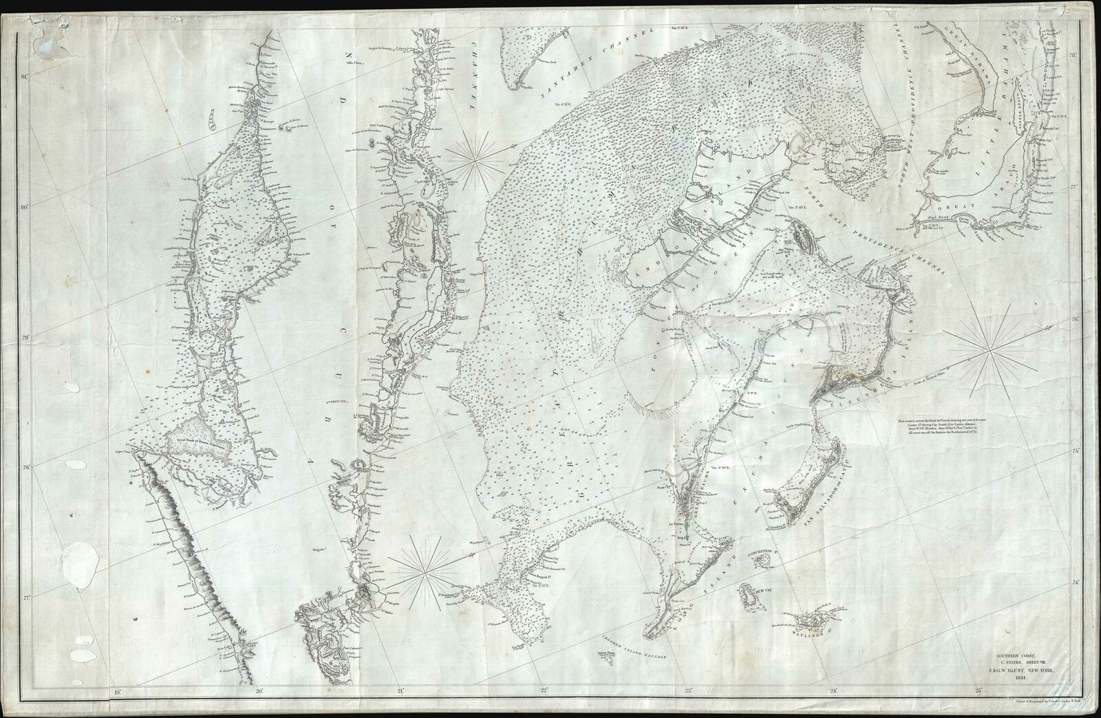
1844 Copley Blueback Nautical Chart or Maritime Map of the Bahamas and Cuba
$ 551.76
- Description
- Size Guide
Description
1844 Copley Blueback Nautical Chart or Maritime Map of the Bahamas and CubaWE SELL ONLY ORIGINAL ANTIQUE MAPS - NOT REPRODUCTIONS
Title:
Southern Coast, U. States. Sheet VIII.
Description:
This is an 1844 Edmund and George William Blunt map of the Bahamas and eastern Cuba. The map depicts the Caribbean from just south of Cuba to Great Abaco, Little Abaco, and the cays to the east of Great Abaco and from the Sagua la Grande River, Cuba and Great Bahama to just east of Santiago de Cuba and Watlings Island. Numerous locations are labeled along the Cuban coast on this highly detailed chart, with a detailed depiction of the small islands and cays situated along the Cuban coastline. The islands of the Bahamas are as meticulously illustrated, with coastal locations, channels, sounds, cays, small islands and other hazards charted. Myriad depth soundings are included, particularly within the Greater Bahama Bank. A note stating the best courses across the Bank is situated on the right side of the map, just below Eleuthera Island.
Blueback Charts
Blueback nautical charts began appearing in London in the late 18th century. Bluebacks, as they came to be called, were privately published large format nautical charts known for their distinctive blue paper backing. The backing, a commonly available blue manila paper traditionally used by publishers to warp unbound pamphlets, was adopted as a practical way to reinforce the low-quality paper used by private chart publishers in an effort to cut costs. The earliest known blueback charts include a 1760 chart issued by Mount and Page, and a 1787 chart issued by Robert Sayer. The tradition took off in the early 19th century, when British publishers like John Hamilton Moore, Robert Blachford, James Imray, William Heather, John William Norie, Charles Wilson, David Steel, R. H. Laurie, and John Hobbs, among others, rose to dominate the chart trade. Bluebacks became so popular that the convention was embraced by chartmakers outside of England, including Americans Edmund March Blunt and George Eldridge, as well as Scandinavian, French, German, Russian, and Spanish chartmakers. Blueback charts remained popular until the late 19th century, when government subsidized organizations like the British Admiralty Hydrographic Office and the United States Coast Survey, began issuing their own superior charts on high quality paper that did not require reinforcement.
Publication History and Census
This map was drawn and engraved by Charles Copley and published by Edmund and George William Blunt in New York in 1844. This chart appears to be half of a larger chart, the other half of which we have not previously encountered.
Size:
Printed area measures 26 inches high by 40 inches wide.
Condition:
Good. Patched holes along left margin. Wear along top margin. Blank on verso.
Shipping:
Shipping rates are not negotiable. Items are shipped within three business days of receiving payment. We are happy to consolidate shipping where possible. The following shipping options are available:
1. FedEx Overnight (45 USD). USA Only. Signature Required.
2. FedEx Ground or Home Delivery (15 USD). USA Only. 1 - 10 days. If your address is a P.O. Box and cannot ship FedEx we will ship USPS Priority and, while we ship promptly, recent postal personnel cutbacks mean that delivery may take time. Signature Required.
3. FedEx International or DHL International EXPRESS (45 USD).
4. We can use your FedEx Account.
Customs:
International buyers are responsible for paying duty and taxes on delivery. DHL or FedEx will contact the buyer by telephone to arrange tax payment if it is levied. Duty varies by country and we cannot predict the amount you will be charged. Some countries are duty free, others are not. Typically, a customs duty and/or VAT tax will be assessed on all parcels to continental Europe. Sometimes duty or tax is due in China, but is seems very random. Hong Kong, Singapore, Korea, and Taiwan have never assessed duty on a map we shipped. Maps shipped to the UK should be duty free as educational materials, but from time to time duty of 5% is assessed incorrectly by the UK customs agents.
Insurance:
All shipments are insured privately against loss and damage. All of our shipments require a signature for insurance purposes.
If you have any questions please feel free to email us through eBay.
Other Services
Conservation Framing:
Geographicus recommends basic conservation framing services for any antique paper. We do not offer this service.
Antique Map Restoration:
Geographicus can repair and restore your antique map. Services include deacidification cleaning flattening and backing.
BEWARE anyone attempting to contact you, from a different eBay account, claiming to represent Geographicus Antique Maps. My eBay handle is GeographicusMaps. If you are contacted by email by someone offering you my items, please call me directly to be certain you are not dealing with a con artist.
"


