-40%
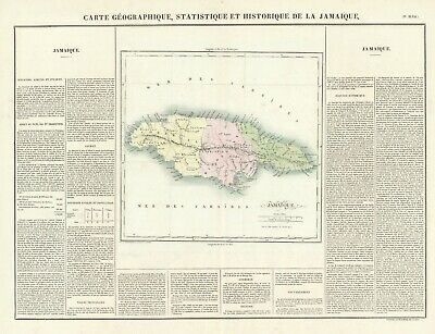
1825 Map of Jamaica
$ 42.24
- Description
- Size Guide
Description
PACIFIC SHORE 'Collectible' MAPSTitle:
Carte Geographique, Statique et Historique de la Jamaique
Cartographer:
Buchon
Date and Place:
1825; Paris
Source: Carey & Lea Atlas, 1st French edition
Dimensions: overall 18 x 24, on a larger sheet; Map is 12 x11; BW Copperplate with full color to map
Condition: VG, clean with unfaded color
Description:
Detailed map of Jamaica, published in Paris.
The map is colored by parishes, and locates roads, towns, rivers and topographical features.
The map appeared in the French edition of Carey & Lea's Atlas and is highly prized not only for its cartographic information but the marvelous information about each of the states and territories included. The atlas was issued in 6 editions in English, French & German between 1822 and 1827
Attractive and historically relevant map.
----------------------------
Also visit “mapseller01” or Google “Pacific Shore Maps” for more cartography


