-40%
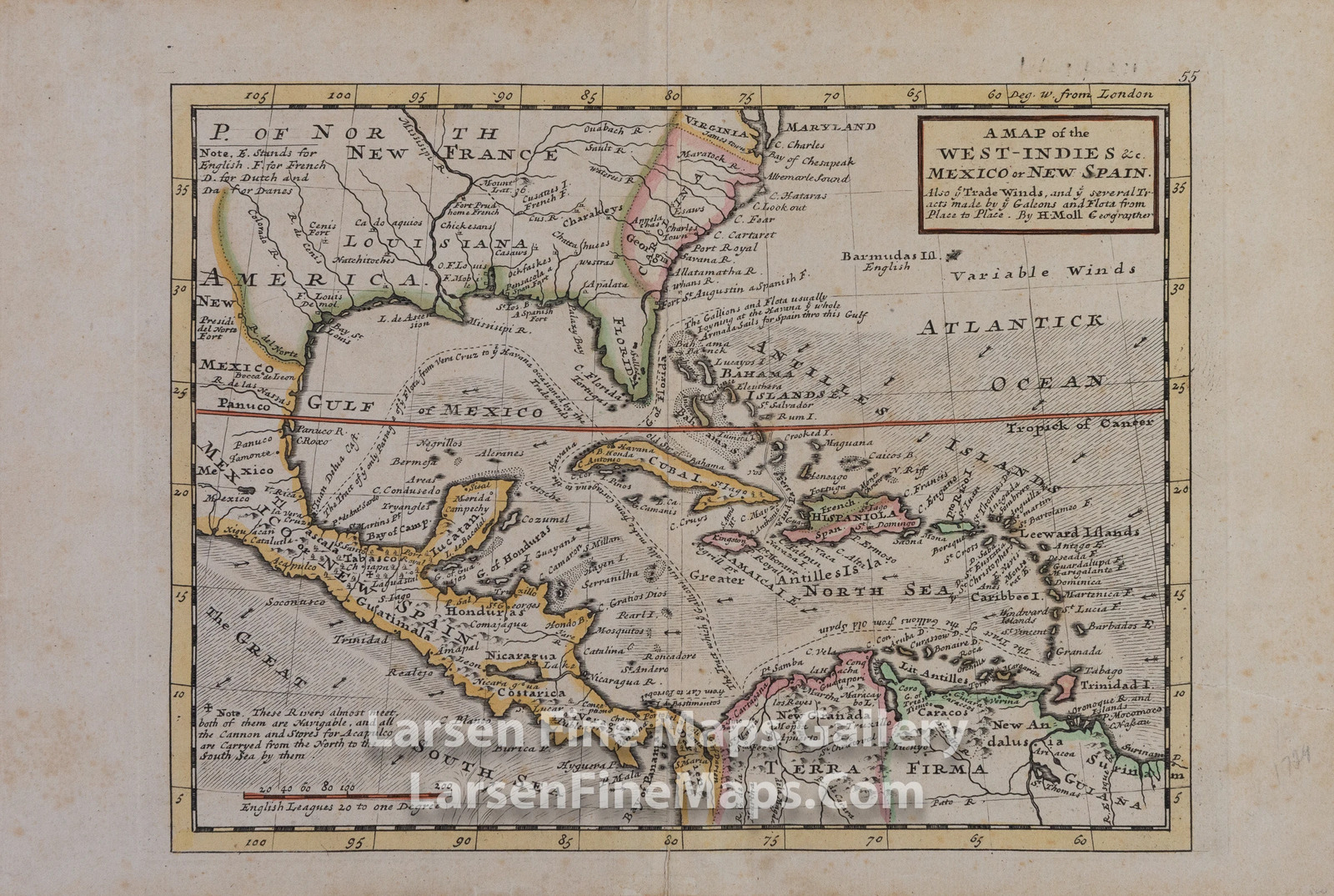
1729 Antique Map of the West-Indies Mexico or New Spain Herman Moll
$ 387.52
- Description
- Size Guide
Description
1729 Antique Map of the West-Indies Mexico or New Spain Herman Moll(See my Gallery for better image) Striking full color example of this attractive map of the Spanish Main generally consisting of the West Indies, Central America, Eastern Mexico, the Southern portion of North America including some of the British Colonies, and the Northern portion of South America.The map shows great detail with an interesting depiction of the coast lines, Florida, Yucatan and the Gulf Coast. The map shows territorial claims (designated by letter as noted in the upper left of the map), forts, ports, towns, waterways, mountains, lakes, islands, and a very interesting notation describing the navigable rivers through New Spain through which cannons and stores were brought to Acapulco. The most interesting characteristic of this map are the tracts of the Spanish treasure Galleons (noted 'Galeons and Flota" as well as "Gallions" on the map) along with commentary on those tracts.
1729 Antique Map of the West-Indies Mexico or New Spain Herman Moll
YEAR PUBLISHED:
1729
CARTOGRAPHER/MAPMAKER:
Herman Moll (c. 1654-1732)
PUBLICATION:
Atlas minor: or a new and curious set of sixty-two maps, in which are shewn all the empires, kingdoms, countries, states, in all the known parts of the earth; with their bounds, divisions, chief cities & towns, the whole composed & laid down agreable to modern history. By Herman Moll, Geographer
PUBLISHER:
Herman Moll (c. 1654-1732)
FULL TITLE:
A Map of the West-Indies & c. Mexico or New Spain. Also ye Trade Winds, and ye several Tracts made by ye Galeons and Flota from place to place. By H. Moll Geographer
CONDITION:
VG with slight overall toning and some foxing. Center fold as issued in atlas. Hand colored.
DIMENSIONS:
13.75 X 9.25
DESCRIPTION:
(See my Gallery for better image) Striking full color example of this attractive map of the Spanish Main generally consisting of the West Indies, Central America, Eastern Mexico, the Southern portion of North America including some of the British Colonies, and the Northern portion of South America.
The map shows great detail with an interesting depiction of the coast lines, Florida, Yucatan and the Gulf Coast. The map shows territorial claims (designated by letter as noted in the upper left of the map), forts, ports, towns, waterways, mountains, lakes, islands, and a very interesting notation describing the navigable rivers through New Spain through which cannons and stores were brought to Acapulco. The most interesting characteristic of this map are the tracts of the Spanish treasure Galleons (noted 'Galeons and Flota" as well as "Gallions" on the map) along with commentary on those tracts.
×
Buy now and save!
Tell a friend
Visit store
Watch now
Postage info
Click the Postage tab above the listing description for more info
FREE Postage
Click the Postage tab above the listing description for more info!
Additional delivery notes
PICK UP OPTION
Sorry, our items are NOT available for pick-up.
PAYING VIA PAYPAL
We accept PayPal on our all our items so you can shop with confidence.
Simple choose the PayPal option when proceeding through the checkout.
Additional Information
No additional information at this time
Ask seller a question
You might also like
1951 Vintage Map of Greenfield Village, Thomas A. Edison, Henry Ford
1829 Antique Map of The County of Surrey
1829 Antique Map of The County of Sussex
1880 Antique USGS Progress Map, George Wheeler
Contact
To contact our Customer Service Team, simply click the button here and our Customer Service team will be happy to assist.
Ask seller a question
© Larsen Fine Maps Gallery
Postage
Shipping is FREE for this item
Payment
Accepted Payment Methods
PayPal
Returns
Returns are
not
accepted
Buyer will pay for return shipping.
eBay integration
by


